
earthly.city 🌍 is, in part, driven by a set of powerful 💪 @ContextVM s in the backend. Technologies like this, in combination with #blossom and #pmtiles allow us to have interesting and novel user flows that the legacy #cucknet wouldn't allow.
These include datasets and maps that are unruggable, user-owned and, if chosen, offline.
All examples are live on #earthlycity and can be tried out.
A user creates his own map from the bounds of an existing FeatureCollection dataset and uses it as his base map (BYOB [Bring Your Own #blossom is coming soon...]):
The resulting map: 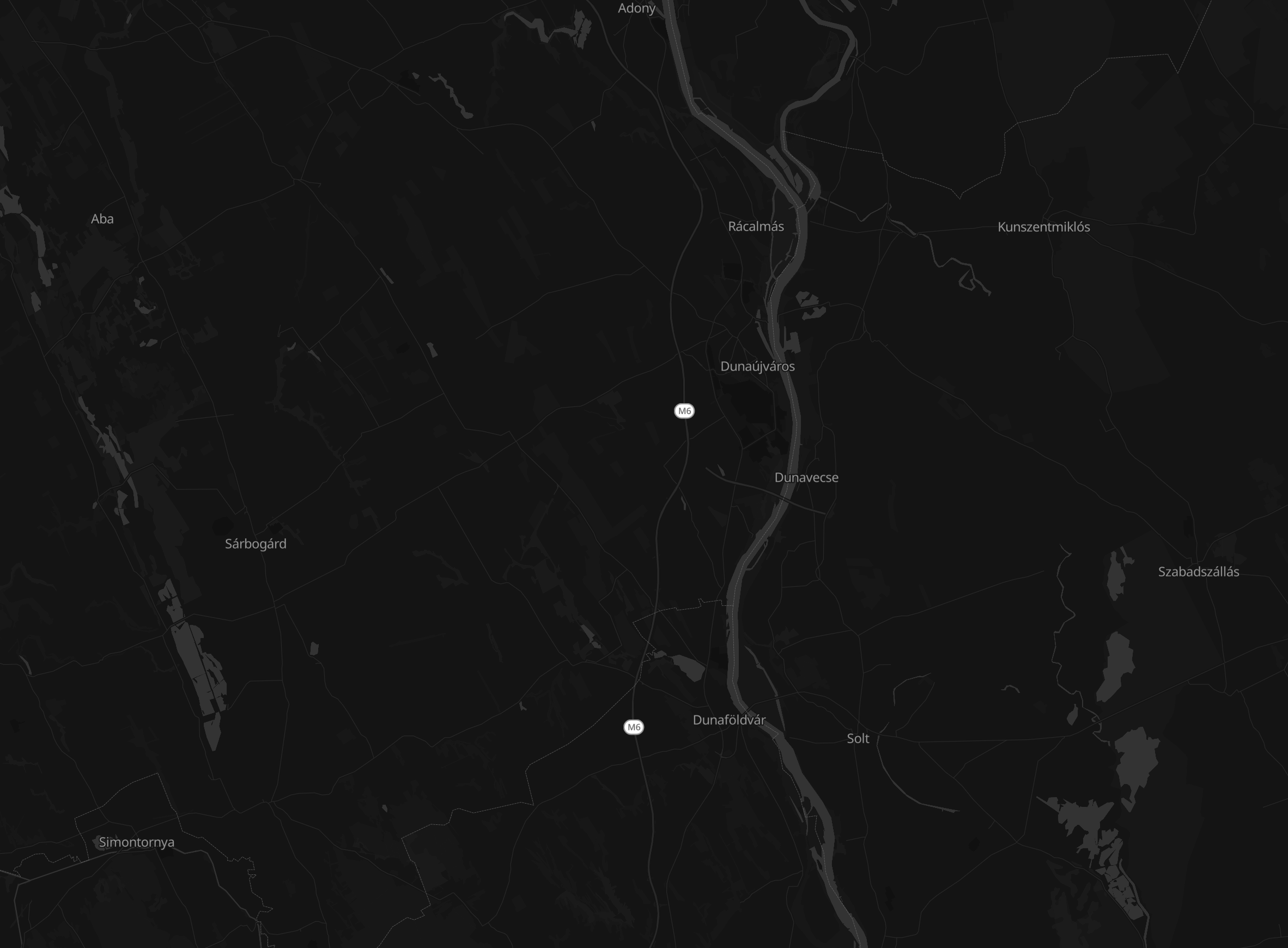 The map can be downloaded and used offline:
 Search and geocode:
OSM base geometry can be lifted out and imported into the edit state:
#blog
Search and geocode:
OSM base geometry can be lifted out and imported into the edit state:
#blog
Earthly
Earthly
Collaborative geographic mapping on Nostr. Create, share, and explore GeoJSON datasets with a decentralized community.
Search and geocode:
OSM base geometry can be lifted out and imported into the edit state:
#blog


 ...THEN do the import:
 It's a bug and the import button should be disabled. Will fix soon.
 "Cloud up" icon in the toolbar next to the map.
